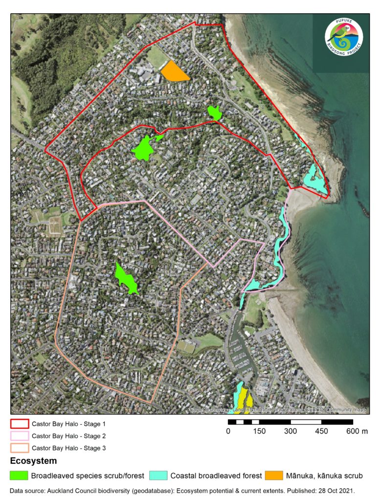
The map below shows the location of our ecological halos and remnant ecosystems. Click on it to learn more.
Castor Bay Ecological Halo
The Castor Bay Halo will be established progressively through three stages, from north to south. The halo will serve to protect three important ecosystems: (1) the mānuka and kānuka scrub at the Campbells Bay School, (2) the broadleaved species scrub/forest at the Braemar Road Reserve and the creek along the road, and (3) the coastal broadleaved forest at Rahopara Historic Reserve.
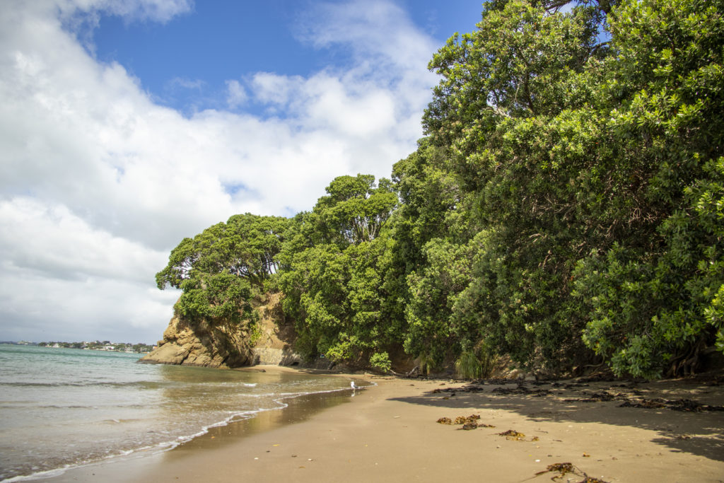
Coastal broadleaved forest at Rahopara Historic Reserve
Regional IUCN threat status: Endangered.
Coastal broadleaved forests are dominated by pōhutukawa, pūriri and taraire. These are all long-lived species that needs space and time to grow, and have thus been shrinking in distributions severely due to deforestation, fragmentation and human settlement.
Due to high palatability and availability of tree cavities as nesting places, they are prone to infestation of pest animals. Coastal broadleaved forests are declared as endangered regional ecosystems and we are blessed to still have remnants of these forests at Castor Bay.
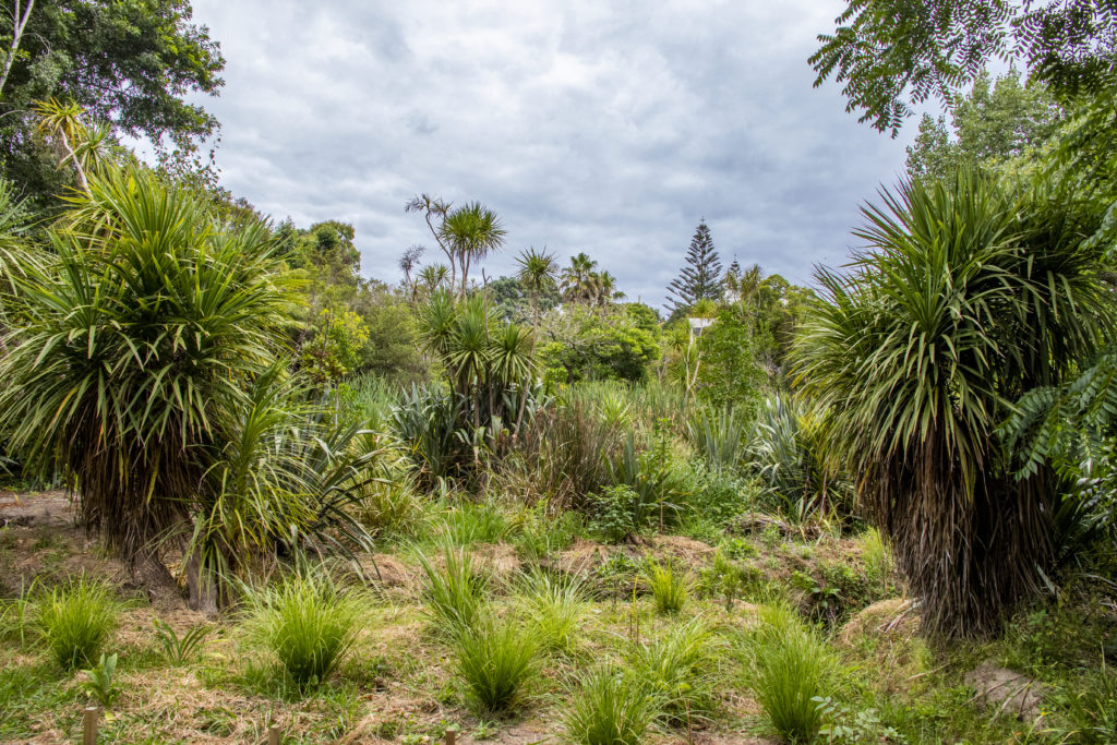
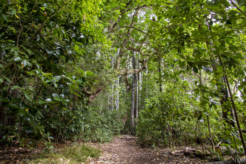
Broadleaved forest is an advanced stage of forest succession dominated by ponga and short-lived (<100 years) tree species, e.g. Coprosma spp., māhoe, māpou, putaputawētā etc.
These forests varied in species composition based on locations, and and sometimes grow within mānuka and kānuka scrub.
It supports a great variety of our native forest birds, e.g. kererū, pīwakawaka, riroriro, tūī and silvereye. The broadleaved forests are palatable to pest animals and are thus severely threatened by the possums and rats that decimate native seedling and depredate on native birds.
Broadleaved forests at Braemar Road Reserve
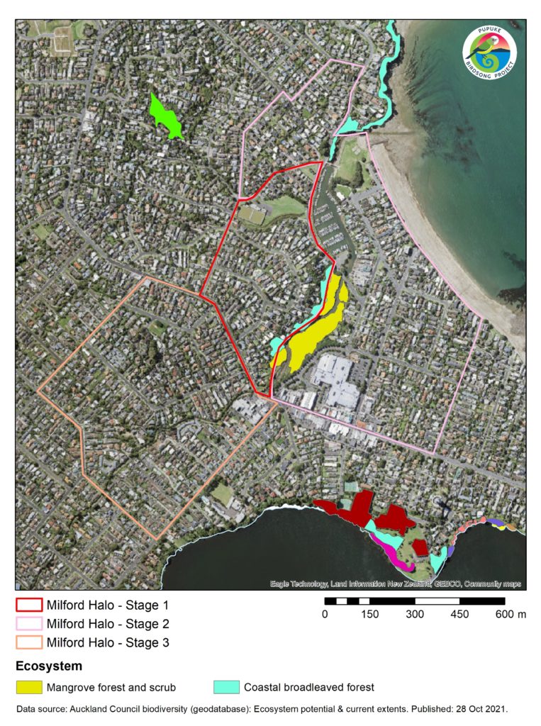
Milford Ecological Halo
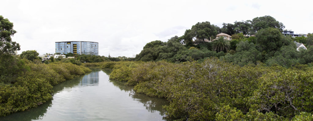
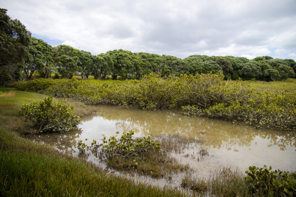
Mangroves and costal broadleaved forests along Wairau Estuary
The Wairau Estuary is connected to the Wairau Valley Catchment that stretches all the way into the Wairau Valley.
The water channels are heavily modified, but the mangrove ecosystems along the channels not only provide important habitats and feeding grounds for native fish, invertebrates and birds, but also important ecosystem functions such as water filtering.
A survey once revealed that the water way is home to at least nine native freshwater fish and crustacean species.
The Milford halo will serve to protect the ecosystems along the Wairau Creek. The halo will also be established in three stages. The first stage will focus on the western side of the Creek, including Bryan Byrnes Reserve where native tree plantings are regularly conducted. Ecosystems along the Wairau Creek include: (1) coastal broadleaved forest, and (2) mangrove forest and scrub.
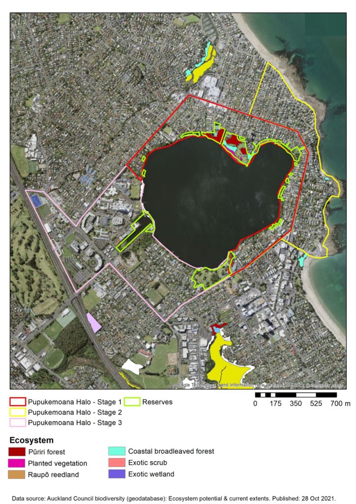
Pupukemoana Ecological Halo
The Pupukemoana Halo will be developed in three stages, which protects the ecosystems surrounding Lake Pupuke. The Kitchener and Sylvan Park at the north of the lake hosts a significant area of Pūriri forest and coastal broadleaved forest. This area has been designated as a significant ecological area and constitutes one of the buffer zones in the Auckland Council Regional Pest Management Plan. Apart from the major reserves, there are also many small reserves around the lake that are connected to private properties that need to be protected.
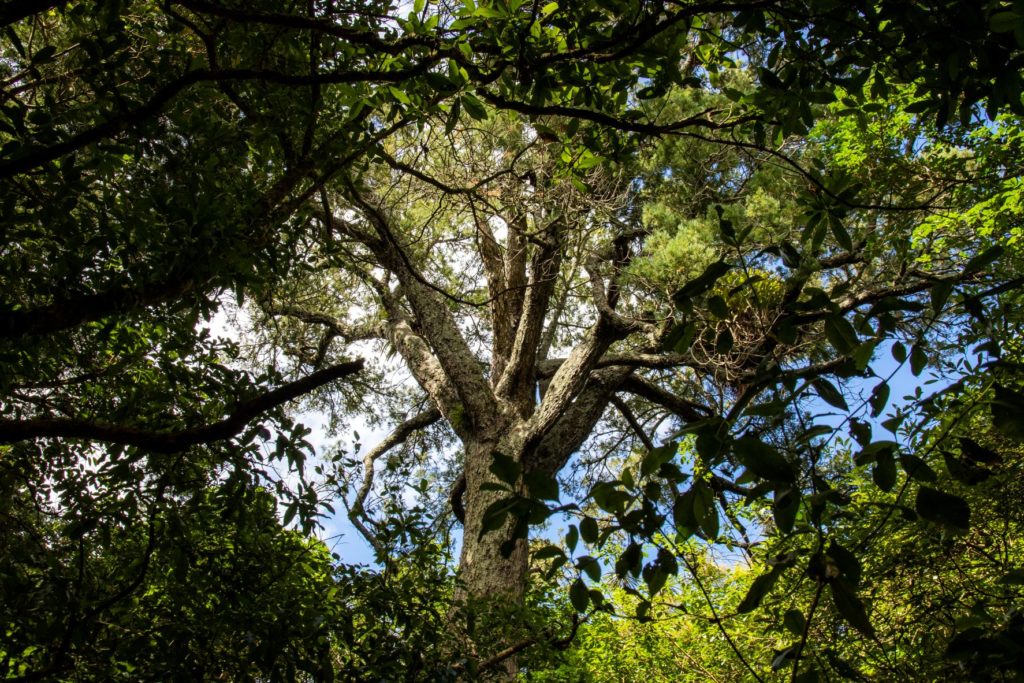
Pūriri forest provides fruit and nectar for native birds. The tree cavities in old Pūriri also provide important shelter and nesting sites for the native birds, bats and reptiles. Pūriri is a host of the largest endemic moth in New Zealand, the Pūriri moths. Pūriri moths spend as much as six years as larvae and emerge and live for only a few days when they mate and lay eggs.
If you take a stroll in Smiths Bush East, you will easily notice some very old Pūriri trees that are important hosts for the native Pūriri moth. The forest also provides fruits and nectar for native bush birds such as morepork, kingfisher, shining cuckoo, fantail, grey warbler and silvereye.
Kahikatea is a podocarp (cone-bearing tree) that flowers and seeds only once every few years, called “masting”. During these years, the trees provide a significant amount of food for native birds, but unfortunately also for the pest animals. Pest control is therefore utmost important in this ecosystem.
The Smiths Bush East Halo is bounded by State Highway 1 on the west, Northcote Road on the north, Taharoto Road on the east and the Rosmini College and Summit Point School in the south.
The halo is established to protect the eastern part of Smiths Bush that is unfortunately bisected by the State Highway 1. Smiths Bush East holds the last remnant Pūriri and Kahikatea forest located within our project area.
Patuone Ecological Halo
The Patuone Halo will be established in two stages, with the first stage focusing on Patuone Reserve, and the second stage on the Hillcrest Creek. Both stages will serve to protect the mangrove forest and scrub ecosystems.
Mangroves at Patuone Reserve
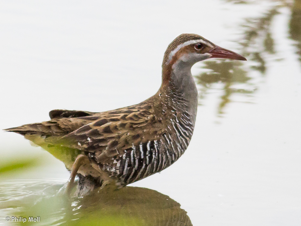
Mangroves are very important ecosystems because they help to filter pollutants, trap sediment, and provide breeding grounds for fish and feeding grounds for some rare birds, e.g. banded rail and marsh crake. Mangrove ecosystems are also habitats for invasive predators including rats and mice, so trapping and baiting are important to protect the rare native birds, as well as native fishes and invertebrates.